
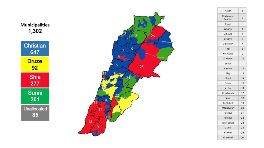
Ethno-Geographic Distribution
Maps of where Lebanon’s communities live, municipality by municipality, grouped by canton and by governorate. Based on the original inhabitants of each municipality, they show the mosaic from which the cantons are drawn.